Copy
Newsletter VisioTerra : August 2017
ZOOM ON HEDAVI AS A PRECURSOR OF SENTINELS
View this email in your browser

Zoom on HEDAVI
as a precursor of Sentinels


HEritage DAta VIsualisation is the Hosted service of visualisation and
sharing of heritage data (ERS and Envisat satellites) and third party
missions (Landsat) data acquired by the European Space Agency (ESA).
 
 
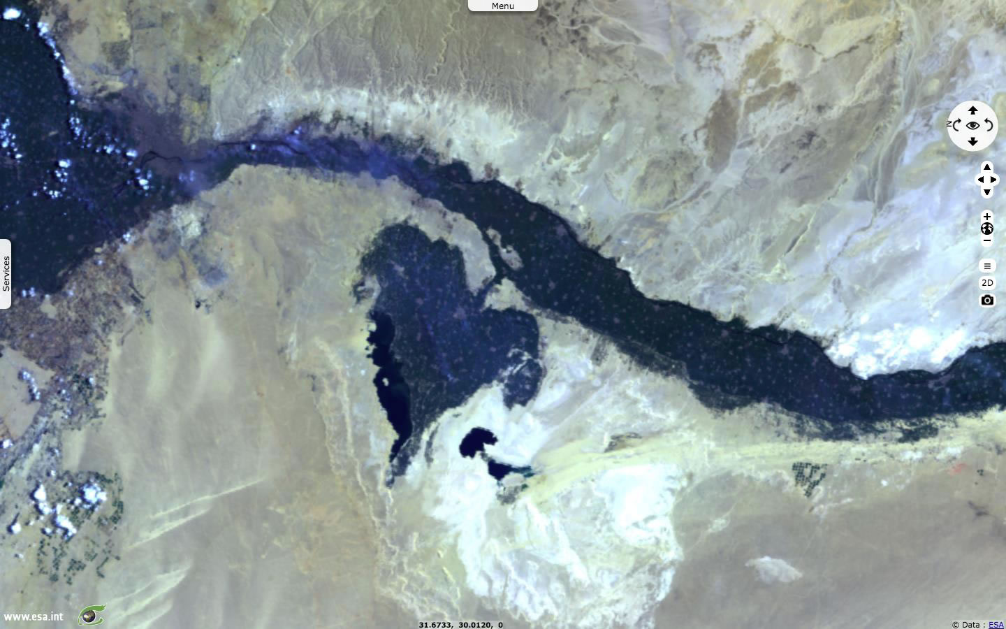
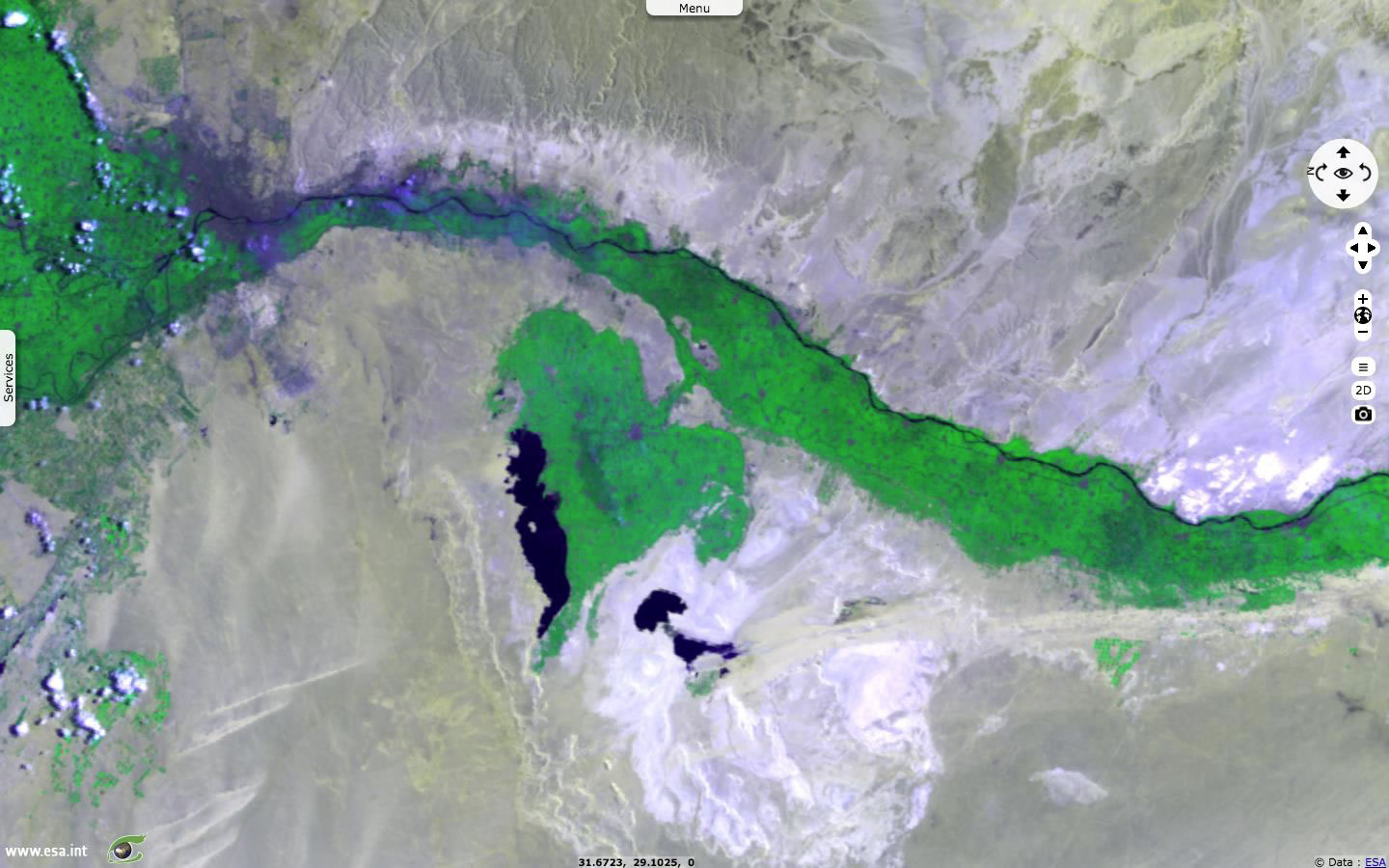
Example of optical image :
ENVISAT - Faiyum oasis

 
· ENVISAT MERIS acquired on 2012-02-02 08:06:56 GMT over Faiyum, Egypt :
MERIS 8-5-2 natural colour image      2D_view

The Faiyum Oasis is a depression in the desert immediately to the west of the Nile south of Cairo.
This large fertile basin is about 70 km wide and 60 km long.

 
MERIS 8-12-2 NIR colour image      2D_view

This colour composition allows us to see the north part of the Nile, that is the second longest river in the world with 6,953 km long.
 
Example of radar image :
ENVISAT Mertz Glacier

 
· ENVISAT ASAR over George V Coast of East Antarctica.    3D animation
Envisat ASAR WSM automatic stretching

In February 2010, a 97 km long iceberg called B-9B (right) rammed into the Mertz Glacier Tongue, a piece of ice of about 78 km long and 35 km wide.
  • Image acquired on 2010-02-16 14:25:09 GMT     2D_view
  • Image acquired on 2010-02-22 14:36:31 GMT     2D_view
Image acquired on 2010-03-01 14:15:05 GMT     2D_view

The collision caused a chunk of the glacier’s tongue to snap off, giving birth to another iceberg named C-28.
GO TO THE HEDAVI PORTAL    

Click here
VIDEO : Overview of the ESA HEDAVI portal. (ENGLISH)
VIDEO : Vue d'ensemble du portail ESA HEDAVI et de ses fonctionnalités. (FRANCAIS)
                                          
  VisioTerra     
           
Copyright © 2017 VisioTerra, All rights reserved.


Want to change how you receive these emails?
You can update your preferences or unsubscribe from this list