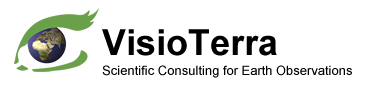
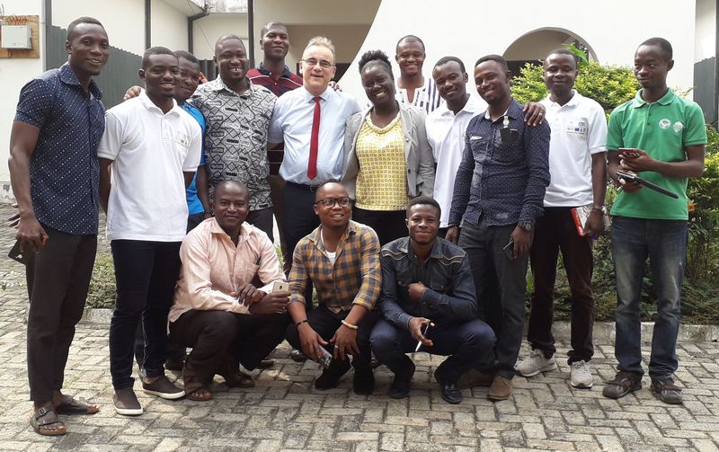
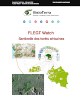
Le mois de décembre 2018 a vu les premières formations dispensées aux "observateurs indépendants" pour l'utilisation du portail "FLEGT Watch" et de son application Android "FLEGT Watch App".
Month of December 2018 saw the first training given to "independent observers" for the use of the "FLEGT Watch" portal and its "FLEGT Watch App" Android application.
Fig.1: Formation Abidjan (Côte d'Ivoire) les 3-4 décembre 2018. Fig.1: Abidjan (Ivory Coast) training on 3-4 December 2018.
Fig.2: Formation Kumasi (Ghana) les 6-7 décembre 2018. Fig.2: Kumasi (Ghana) training on 6-7 December 2018.
Fig.3: Formation Yaoundé (Cameroun) les 17-18 décembre 2018. Fig.3: Yaounde (Cameroom) training on 17-18 December 2018.
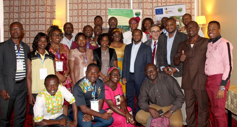
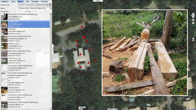
Fig.4: "FLEGT Watch App" - Mission de terrain - Collecte de photos, vidéos et enregistrements audio. Fig.4: "FLEGT Watch App" - Field mission - Collect of photos, videos, and audio records.
Fig.5: "FLEGT Watch" - Visualisation de retours de mission: photos, vidéos, enregistrements de témoignages. Fig.5: "FLEGT Watch" - Visualisation of mission material: photos, videos, interview records.
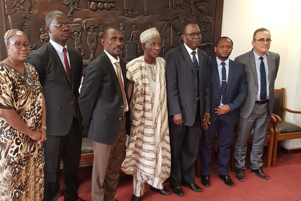
Le 20 décembre 2018, Aurelian MBZIBAIN (CIDT), Serge MOUKOURI (FLAG) et Serge RIAZANOFF (VisioTerra) ont été reçus au Ministère de l'Environnement pour présenter le projet "FLEGT Watch" de surveillance de la déforestation ainsi que le potentiel des données et services gratuits Copernicus pour le suivi environnemental au Cameroun.
On December 20, 2018, Aurelian MBZIBAIN (CIDT), Serge MOUKOURI (FLAG) and Serge RIAZANOFF (VisioTerra) were received at the Ministry of the Environment to present the "FLEGT Watch" project to monitor deforestation and the potential of the free Copernicus data and services for environmental monitoring in Cameroon.
Fig.6: Son Excellence le Ministre de l'Environnement Pierre HELE (5ème de gauche à droite), son Excellence le Ministre Délégué Aboubakar NANA (4), Monsieur l'Inspecteur n°1 John GOUNES TOUGOULOU (2), Madame l'Experte en Géomatique Michèle MESSINA (1) recevant messieurs Aurelian MBZIBAIN (6), Serge MOUKOURI (3) et Serge RIAZANOFF (7). Fig.6: His Excellency the Minister of Environment Pierre HELE (5th from left to right), His Excellency Deputy Minister Aboubakar NANA (4), the Inspector No.1 John GOUNES TOUGOULOU (2), the Expert in Geomatics Michèle MESSINA (1), receviving Misters Aurelian MBZIBAIN (6), Serge MOUKOURI (3) and Serge RIAZANOFF (7).
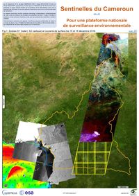
Fig.7: Scènes Sentinel-1 (radar), Sentinel-2 (optique) et courants océaniques CMEMS observés les 15 et 16 décembre 2018 au-dessus ou au large du Cameroun. Fig.7: Scenes Sentinel-1 (radar), Sentinel-2 (optical) and CMEMS ocean currents observed on 15 and 16 December 2018 over and offshore Cameroon.
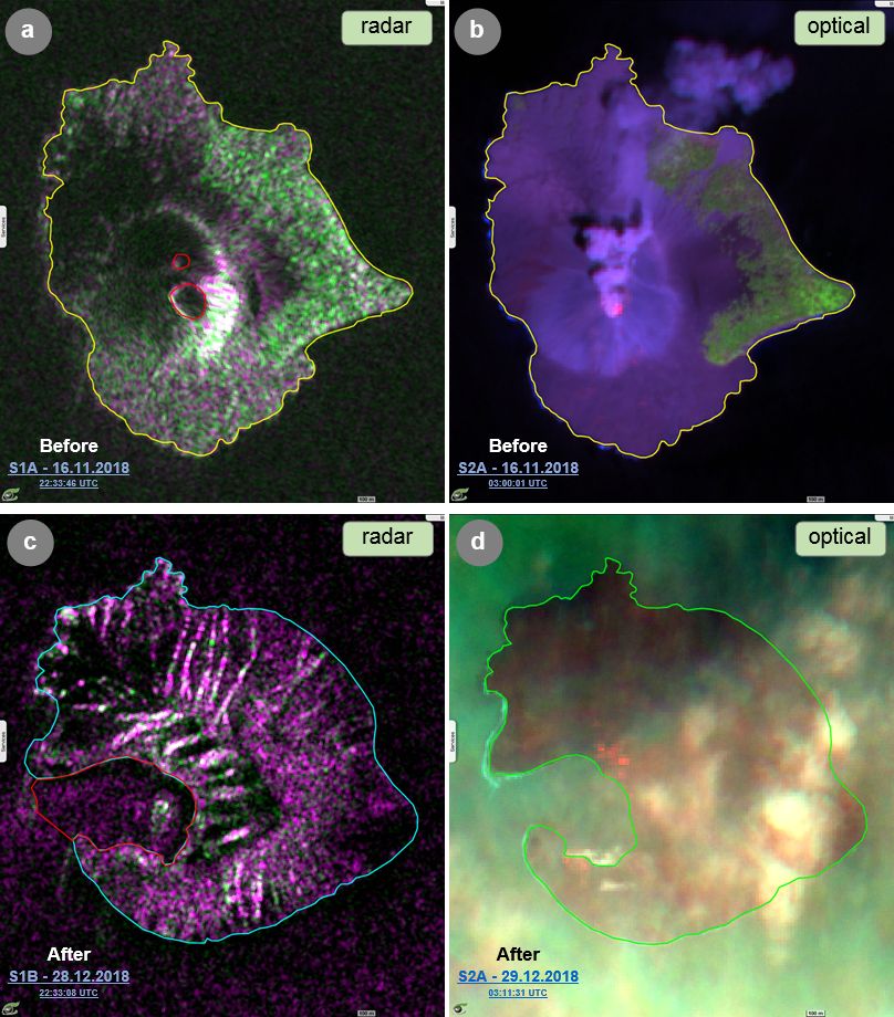
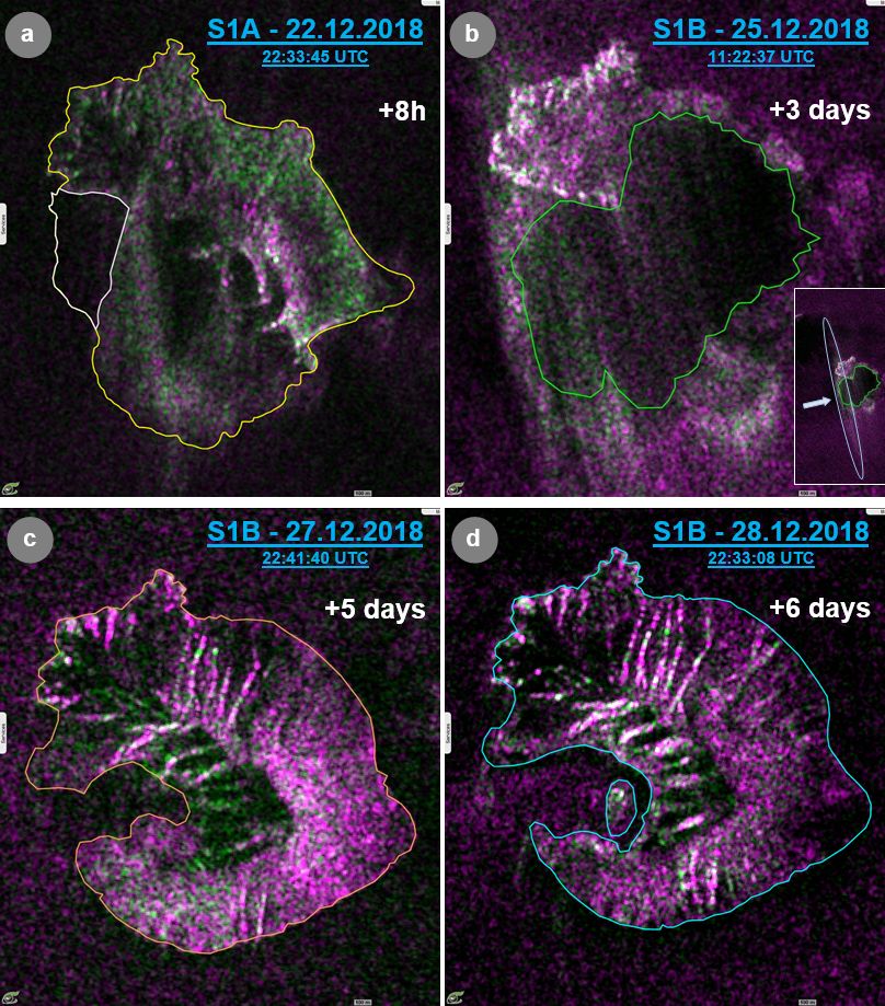
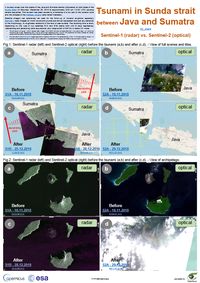
Un tsunami a balayé les côtes des îles de Java et de Sumatra (Indonésie) des deux côtés du Détroit de la Sonde le samedi 22 décembre 2018 vers 21h30 (14h30 UTC), faisant de nombreuses victimes. Ce tsunami a été provoqué par un glissement de terrain d’une partie basse du cône volcanique et par l’effondrement du volcan Krakatau (également appelé Krakatao).
A tsunami swept over the coasts of the Java and Sumatra islands (Indonesia) on both sides of the Sunda Strait on Saturday, December 22, 2018 at approximately 9:30 pm (14:30 UTC) causing severe casualties. This tsunami has been caused by a landslide of a low part of the volcanic cone and the collapse of the Krakatau volcano (also called Krakatao).
Fig.8: Sentinel-1 radar (gauche) et Sentinel-2 optique (droite) avant le tsunami (a,b) et après (c,d). - Vue de l’île Anak Krakatau. Fig.8: Sentinel-1 radar (left) and Sentinel-2 optical (right) before the tsunami (a,b) and after (c,d). - View of Anak Krakatau island.
Fig.9: Série d’acquisitions Sentinel-1 (radar) après quelques heures et quelques jours après l’événement du tsunami. Fig.9: Series of Sentinel-1 (radar) acquisitions in the few hours and days after the tsunami event.
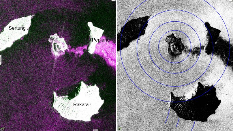
Fig.10: Scène Sentinel-1 acquise le 22 décembre 2018 - Composition colorée VV,VH,VV (gauche) et VV négatif (droite). Fig.10: Sentinel-1 scene acquired on 22 December 2018 - Colour composite VV,VH,VV (left) and VV negative (right).
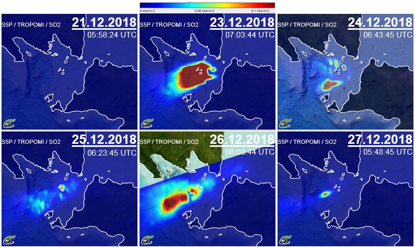
Fig.11: Sentinel-5P / TROPOMI / Colonne totale de dioxyde de soufre (SO2). Animation_2D Fig.11: Sentinel-5P / TROPOMI / Sulphur dioxid (SO2) total column.
Les opinions exprimées dans ce document reflètent uniquement les résultats des travaux et l'opinion de VisioTerra.
The views expressed herein reflect solely the results of the works and the opinion of VisioTerra.