Congrès GMES&Africa La Commission de l'Union africaine a convoqué un atelier continental sur l'eau et les ressources naturelles du 13 au 15 juin à Lusaka, en Zambie.
VisioTerra salue le congrès de GMES&Africa et lui souhaite tout le succès pour la phase 2. En savoir plusGMES&Africa Congress
The African Union Commission convened a continental workshop on water and natural resources June 13-15 in Lusaka, Zambia.
VisioTerra welcomes the GMES&Africa Congress and wishes all success for the Phase 2. Learn more
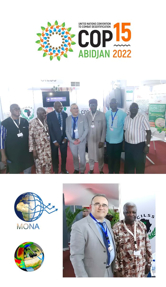
VisioTerra à la COP15
VisioTerra a rencontré les dirigeants et ingénieurs du CILSS (Comité permanent Inter-Etats de Lutte contre la Sécheresse dans le Sahel) pour présenter :
En conclusion d'une visite réalisée a l'AGEOS du 17 au 20 mai qui incluait une formation à l'outil CAFWS de surveillance de la déforestation, l'AGEOS et VisioTerraont scellé leur collaboration à travers un Protocole d'Accord.
MoU between VisioTerra and AGEOS
At the end of a visit to AGEOS from May 17 to 20, which included a training on the CAFWS tool of deforestation monitoring, AGEOS and VisioTerra have sealed their collaboration through a Memorandum Of Understanding.
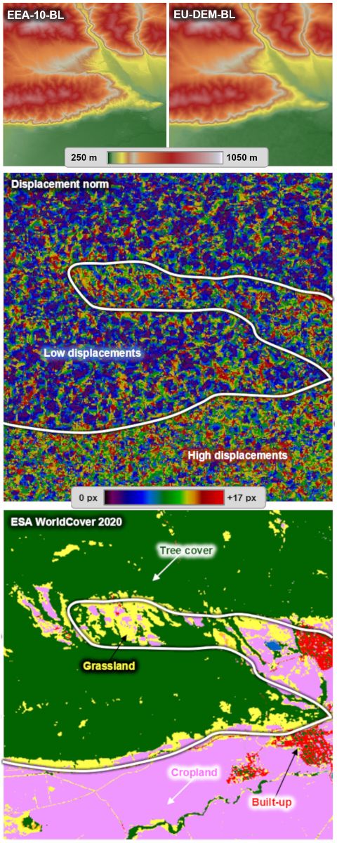
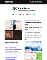
EU-DEM vs. EEA-10
VisioTerra présente une méthode d'analyse de disparité permettant d'estimer les déplacements horizontaux entre deux Modèles Numériques d'Elevation (MNE).
Sur les 38 sites européens étudiés, d'importants déplacements sont observés entre les MNE EU-DEM et Copernicus DEM EEA-10. La grandeur de ces déplacements est influencée par l'occupation du sol, et par les données sources utilisées pour générer chaque MNE. Voir l'étude complète
EU-DEM vs. EEA-10
In this study, VisioTerra introduces a disparity analysis method allowing to estimate the horizontal displacements between two Digital Elevation Models (DEM).
Over the 38 European areas studied, high displacements are observed between EU-DEM and Copernicus DEM EEA-10. The magnitude of these displacements is influenced by the land use, and by the source data used to generate each DEM. See full study
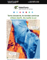
Transhumance vue par Sentinel-2
Pendant la saison sèche, les troupeaux transhument du nord au sud. Ici, les chemins de transhumance convergent vers un puits. Voir la story Sentinel Vision
2022 Desertification and Drought Day
During the dry season, herds transhume from north to south. Here, transhumance paths converge towards a well. See the Sentinel Vision story
Les opinions exprimées dans ce document reflètent uniquement les résultats des travaux et l'opinion de VisioTerra.
The views expressed herein reflect solely the results of the works and the opinion of VisioTerra.