CGMW (Commission for the Geological Map of the World) is an international non-profit association governed by French law and is responsible for designing, coordinating, preparing and publishing small-scale thematic Earth Science maps of the globe, continent, major regions and oceans. The CGMW is affiliated to the International Union of Geological Sciences (IUGS) and the International Union of Geodesy and Geophysics (IUGG), and is supported by UNESCO.
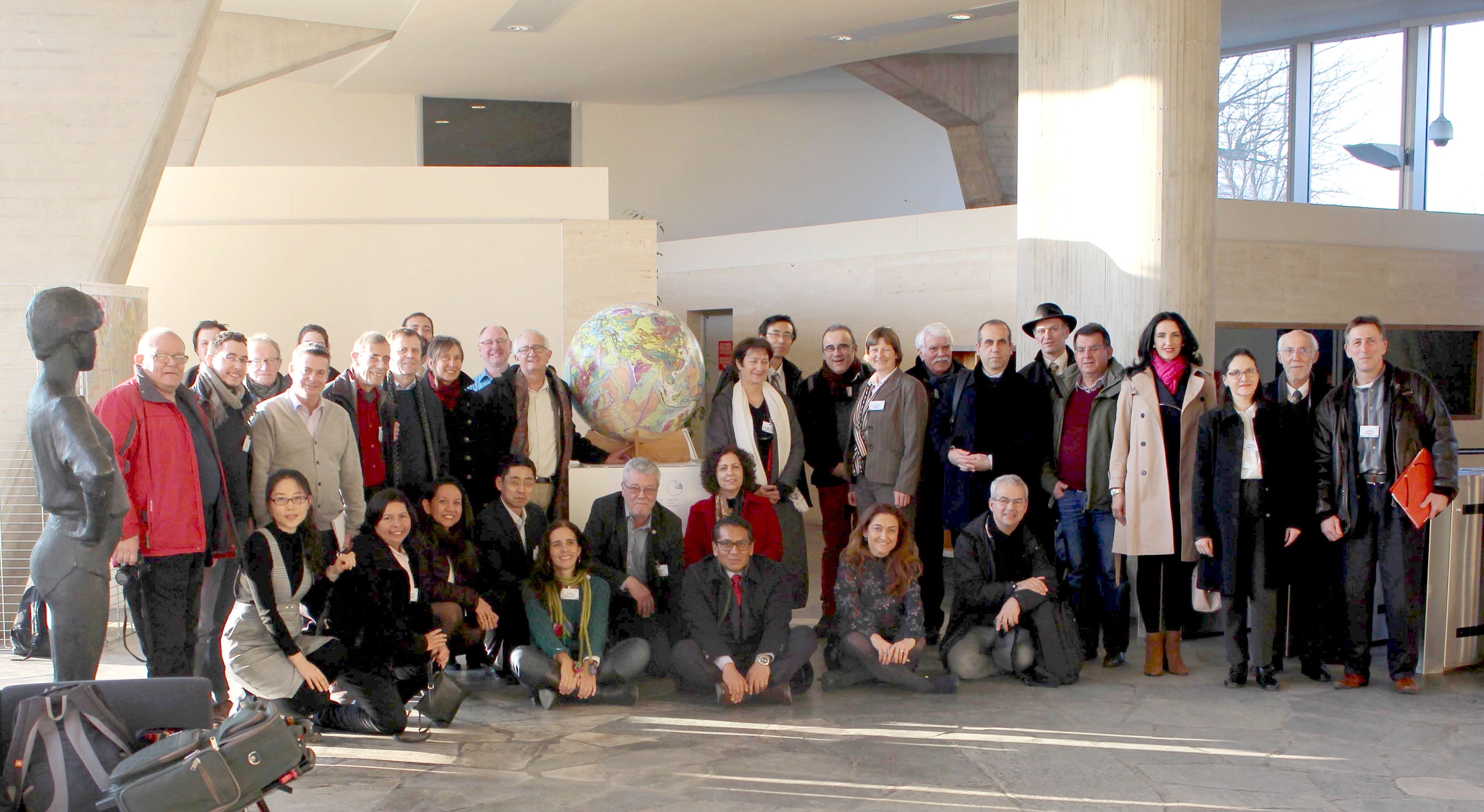
CGMW has invited VisioTerra to its General Assembly held on 22 and 23 February 2018 at UNESCO headquarters in Paris, France.
Manuel PUBELLIER, President of CGMW, and Serge RIAZANOFF, Director of VisioTerra, have presented five “hyperlooks” among the numerous geological maps produced / managed by CGMW and freely accessible in VtWeb.
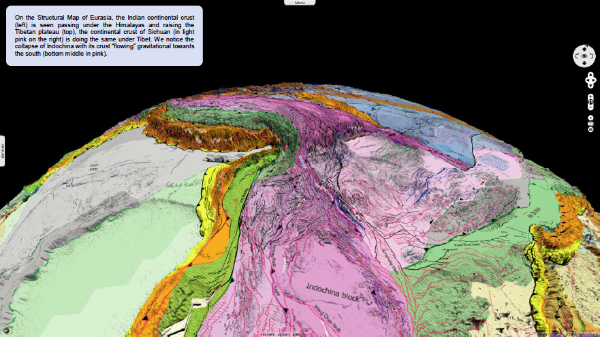
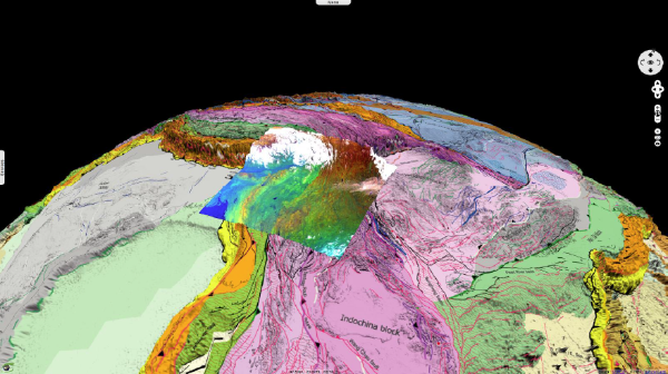
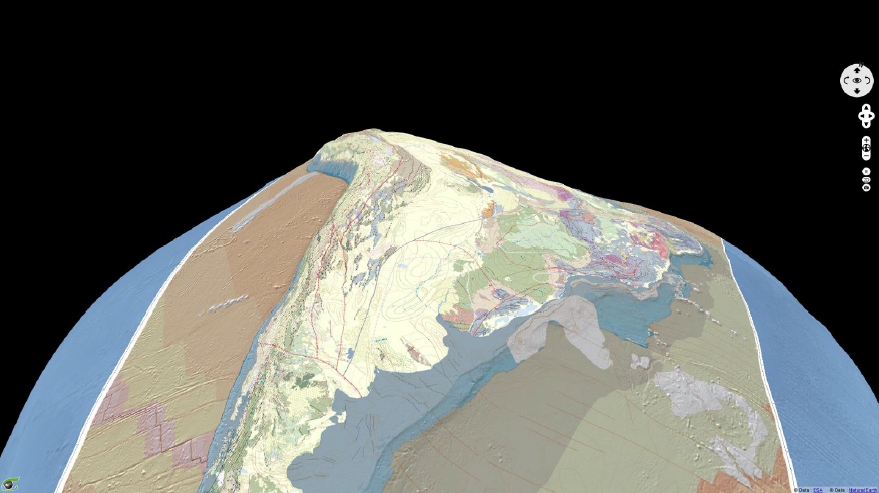
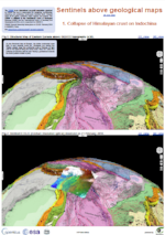
1. Collapse of Himalayan crust
on Indochina
On the Structural Map of Eurasia, the Indian continental crust(left) is seen passing under the Himalayas and raising theTibetan plateau (top), the continental crust of Sichuan (in light pink on the right) is doing the same under Tibet. We notice the collapse of Indochina with its crust “flowing” gravitational towards the south (bottom middle in pink).
Fig.2: Sentinel-3 OLCI (medium resolution optical) observed on 21 February 2018. 2D_view . 3D_view
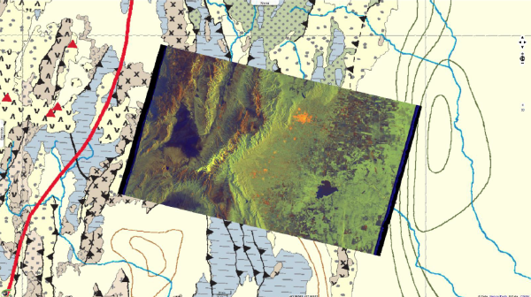
2. Andes (Tectonic Map) and
long wavelength topography
on Geoid
Fig.3: Illustration of the subduction of the Pacific (Nazca plate in brown on the left), under the Andes which are severely uplifted suggesting a rather flat inter-plate contact underneath the Andes. We also see a gradual slope of the South American continental crust to the east (right) which becomes milder under the Amazon craton (far right).
Fig.4: The eastern front of the Andean Fold-and-Thrust Belt is seen with sediments carried towards the range (notice sawteeth pointing to the right), contrarily to many mountain fronts, and shows a typical “triangular zone”; meaning the basin to the right of the sat image is carried toward the range.
Fig.3: Tectonic Map of South America above GOCE geoid (x10000). 2D_view 3D_view
Fig.4: Sentinel-1 C-SAR IW (radar) observed on 17 July 2017 in descending orbit (09:45:06 GMT). 2D_view3D_view
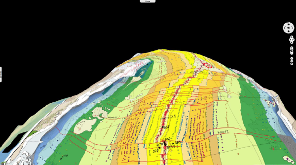
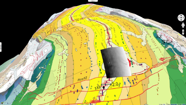
3. Mid-Atlantic Ridge
and oceanic subsidence
with age on Geoid
The oceanic mid-Atlantic ridge responsible for the separation of Africa and South America highlights a thermal dome that is homogeneous and "cylindrical" not only from the point of view ofgeological ages but also from the point of view of the topography; thus implying the morphology of the ocean floor is controlled by the density of the plates which increases (as temperature decreases) away from the ridge and therefore creates an increase in depth. The thermal dome evidences there is an age / depth relationship.
Fig.5: Structural Map of the Atlantic Ocean above GOCE geoid (x10000). 2D_view3D_view
Fig.6: Envisat ASAR WSM acquired on 18 March 2012 at 12:14:57 GMT. 2D_view3D_view
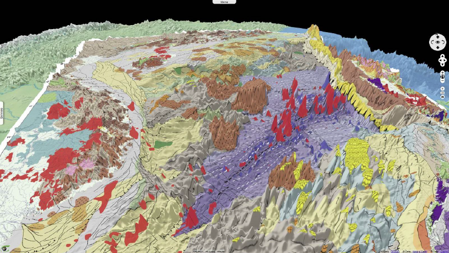
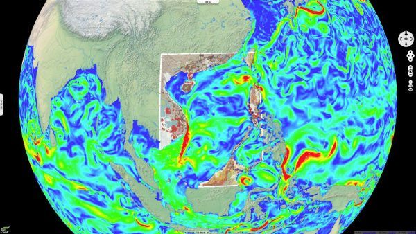
4. South China Sea Bathymetry
and structures
The South China Sea seen from the South. The Tertiary oceanic crust is purple in the shape of a "V" (scissor opening). The continental crust is much stretched over 2000 km on each side of the "V". On this stretched crust stand out the old granites of the Early Cretaceous (in brown). Recent volcanoes (Plio-Quaternary) piercing through the oceanic part stand out near the ridge axis (although the ocean spreading ceased 15 Ma ago), and are also present in the highlands of Vietnam.
Fig.7: Structural Map of the South China Sea above GEBCO (x30). 2D_view3D_view
Fig.8: Copernicus Marine Environment Monitoring Service (CMEMS) for 1st February 2018. 2D_animation3D_view
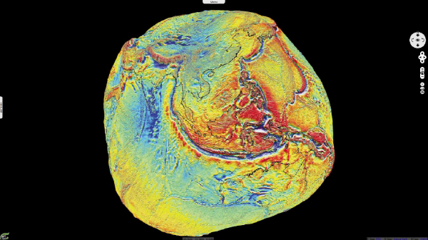
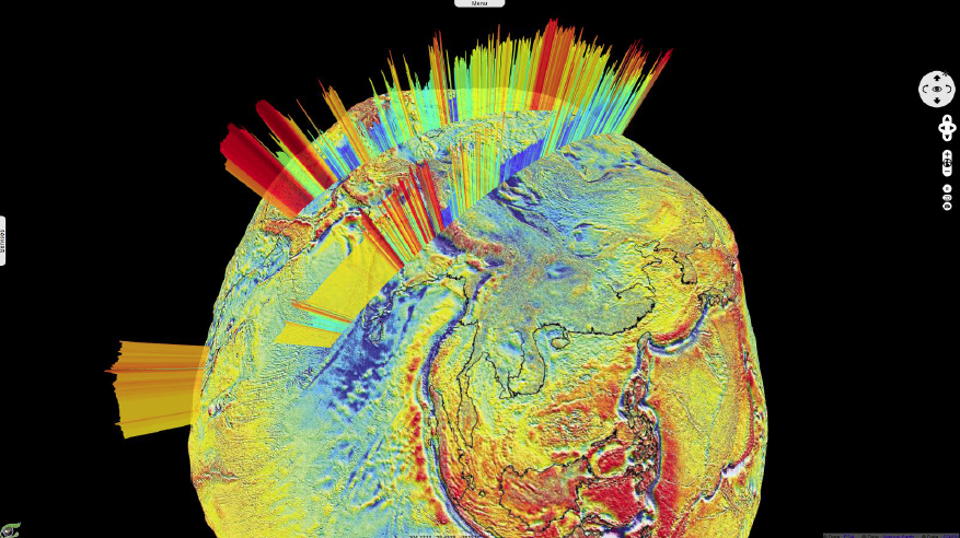
5. Isostatic World Gravity on Geoid
Geoid anomalies with a depression on Sri Lanka and a hump over Indonesia and New Guinea. We see (on the Sunde subduction zone) the bulging of the Australian oceanic plate before it plunges into the subduction zone. We see to a certain extent the same pattern for the Indian plate (which is continental) which makes a bulge before being underthrusted beneath Eurasia with a longer wavelength.
Fig.9: Isostatic World Gravity above the GOCE geoid (x10000). 2D_view3D_view
Fig.10: Sentinel-3 SRAL (altimeter) backscatter coefficient 1Hz C band (dB) observed on 24-07-2016 and 02-01-2017. 3D_view
Les opinions exprimées dans ce document reflètent uniquement les résultats des travaux et l'opinion de VisioTerra.
The views expressed herein reflect solely the results of the works and the opinion of VisioTerra.