PAPFor (Support programme for the preservation of forest ecosystems in West Africa) aims to promote an endogenous, sustainable and inclusive development of West African forest areas, responding to the challenges of climate change and the maintenance of biodiversity.
To effectively and efficiently protect biodiversity and priority forest ecosystems in West Africa, contributing to climate change resilience and food and water security.
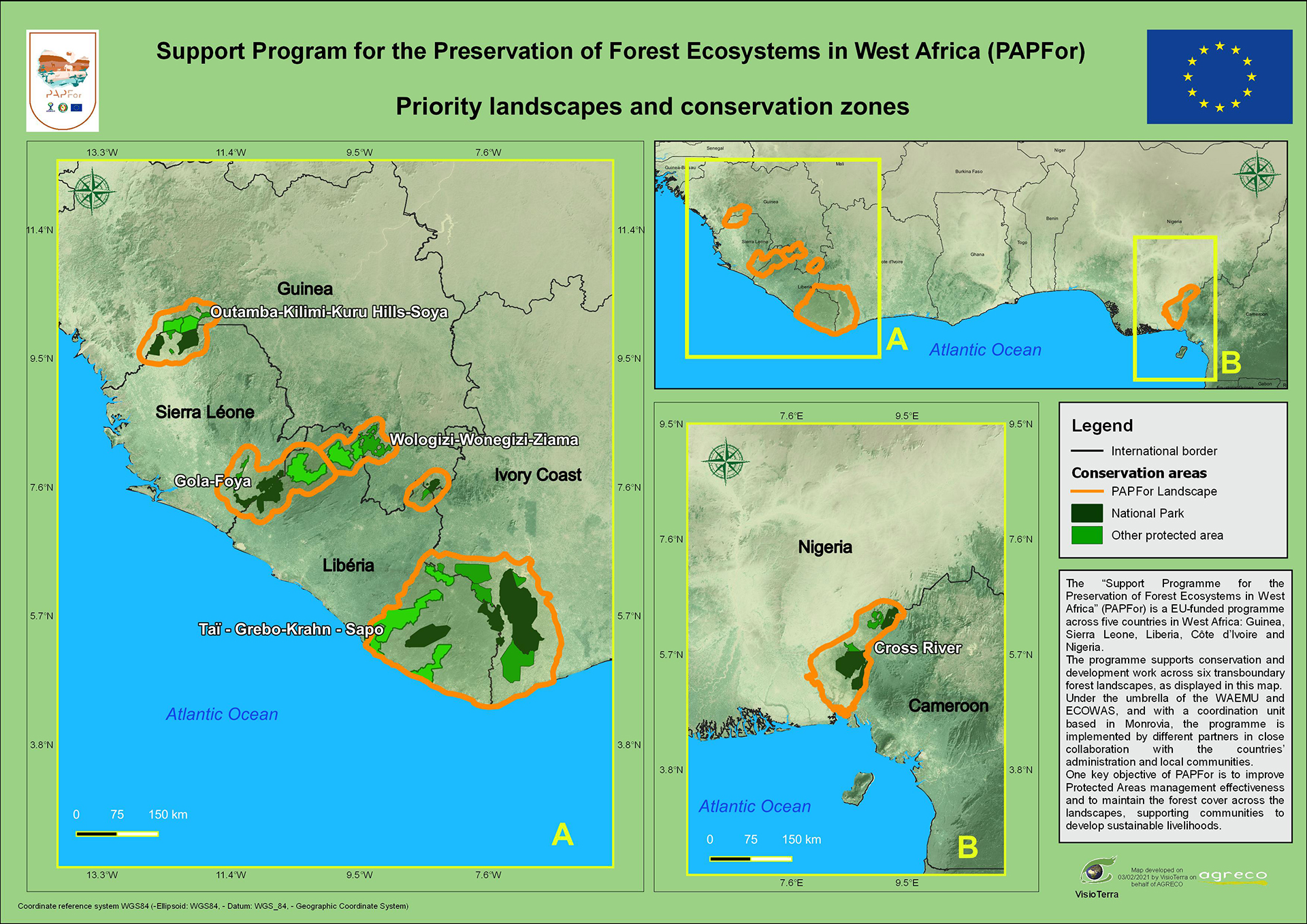
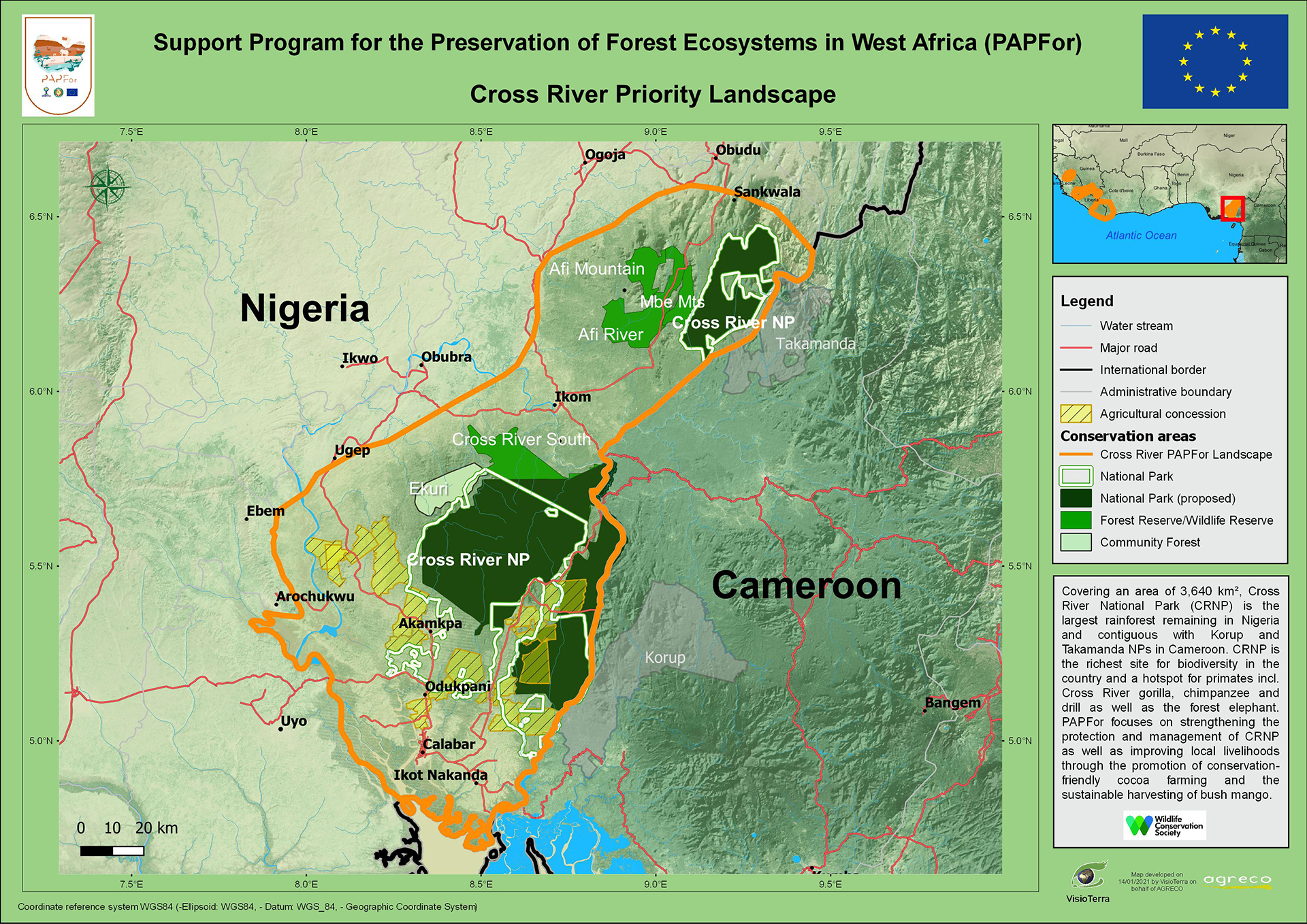
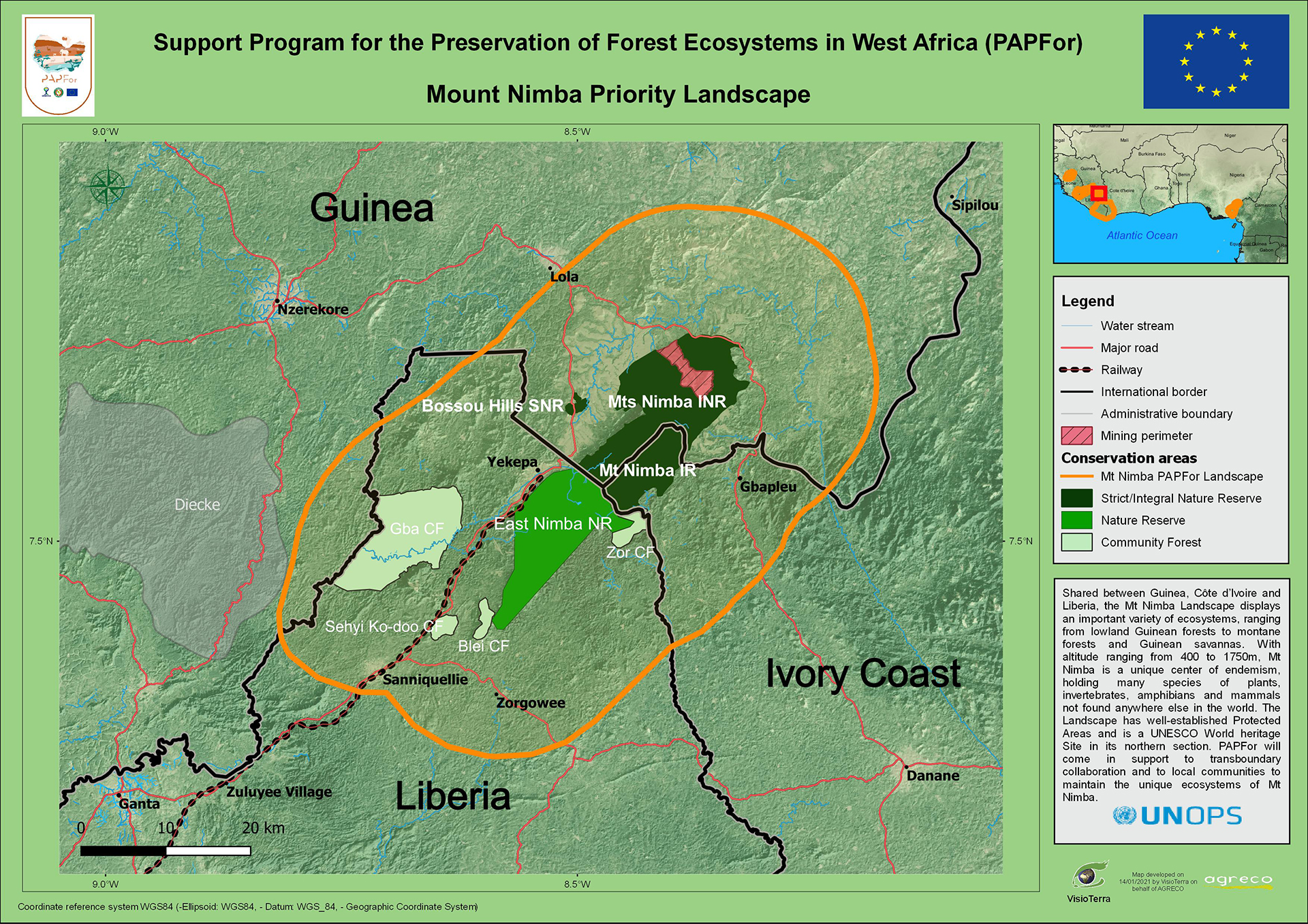
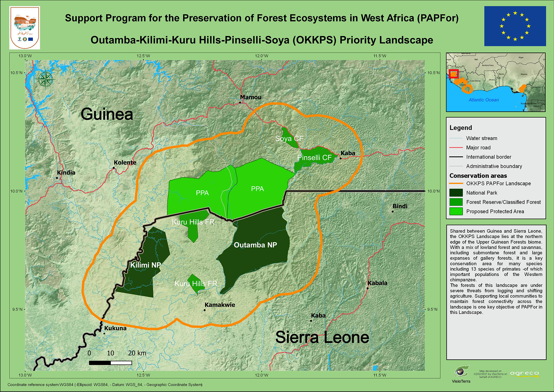
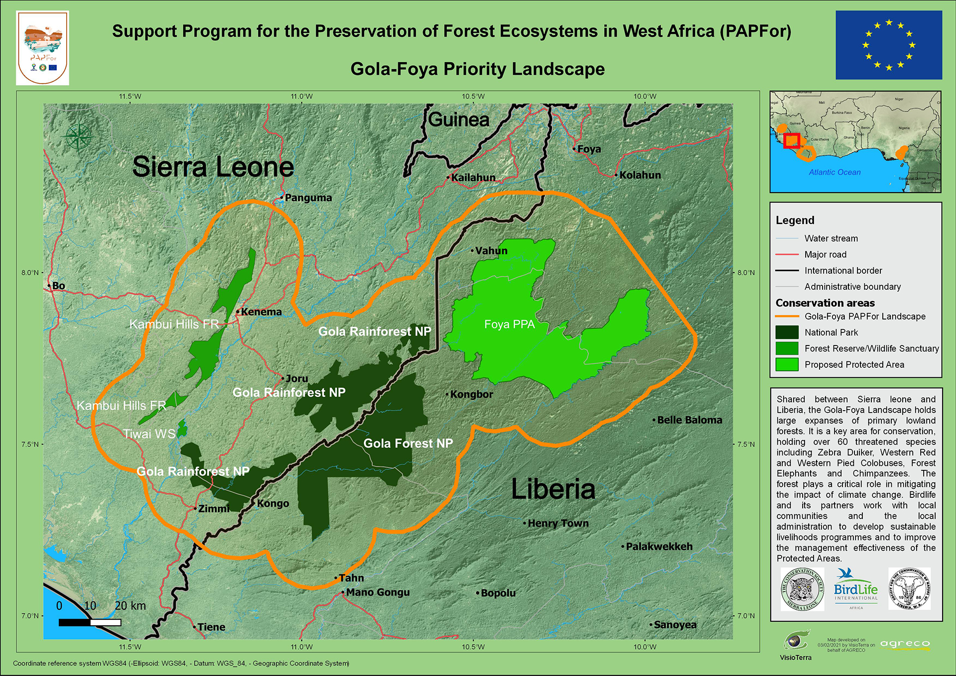
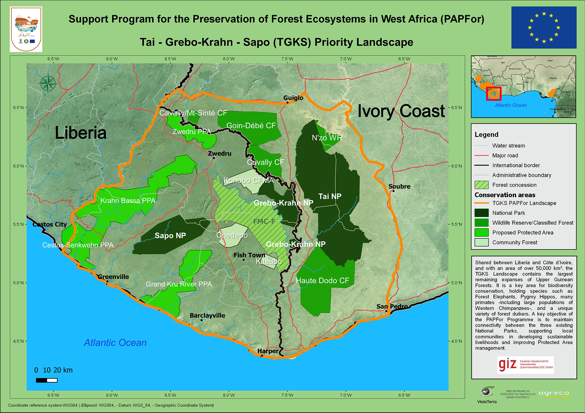
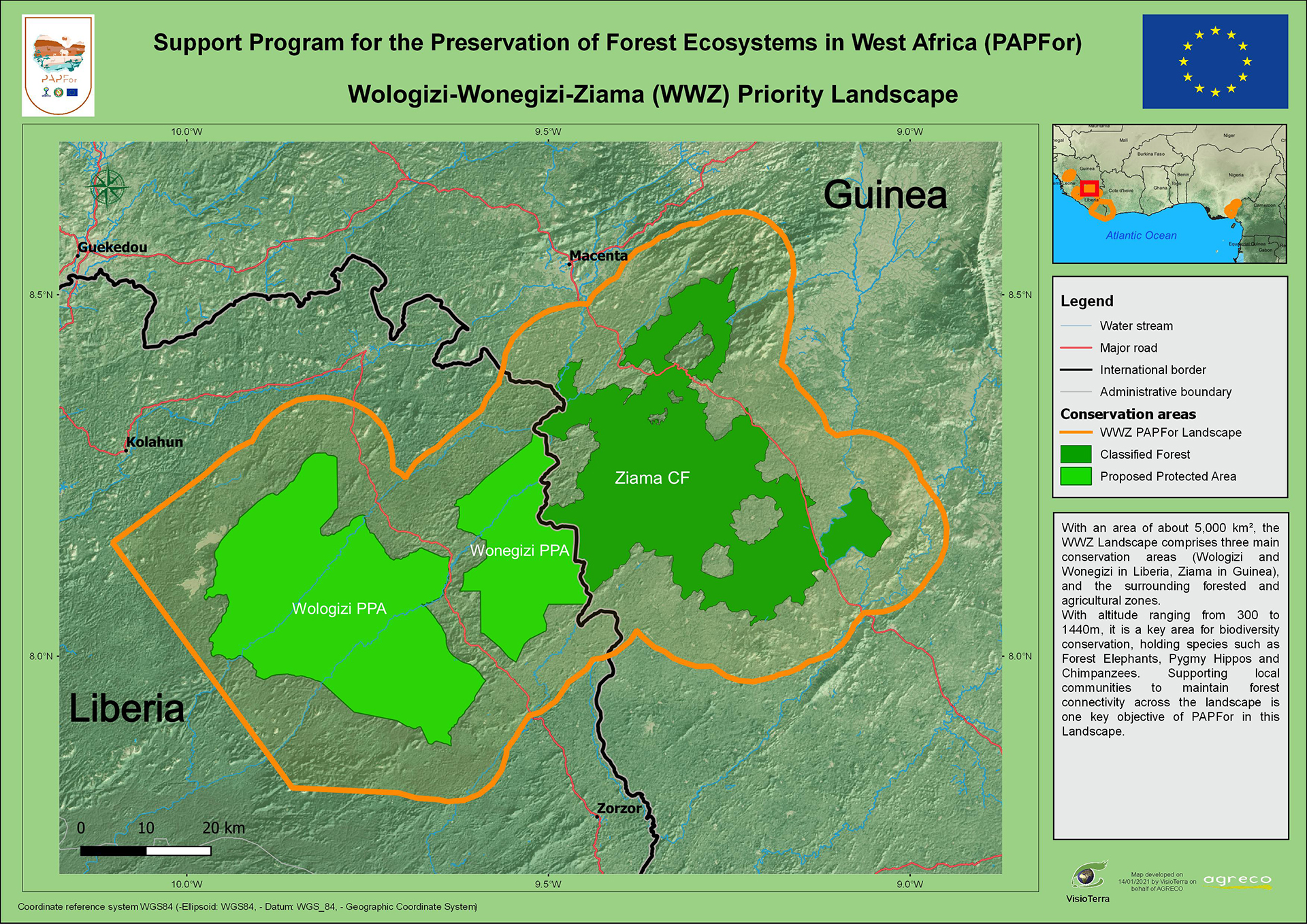
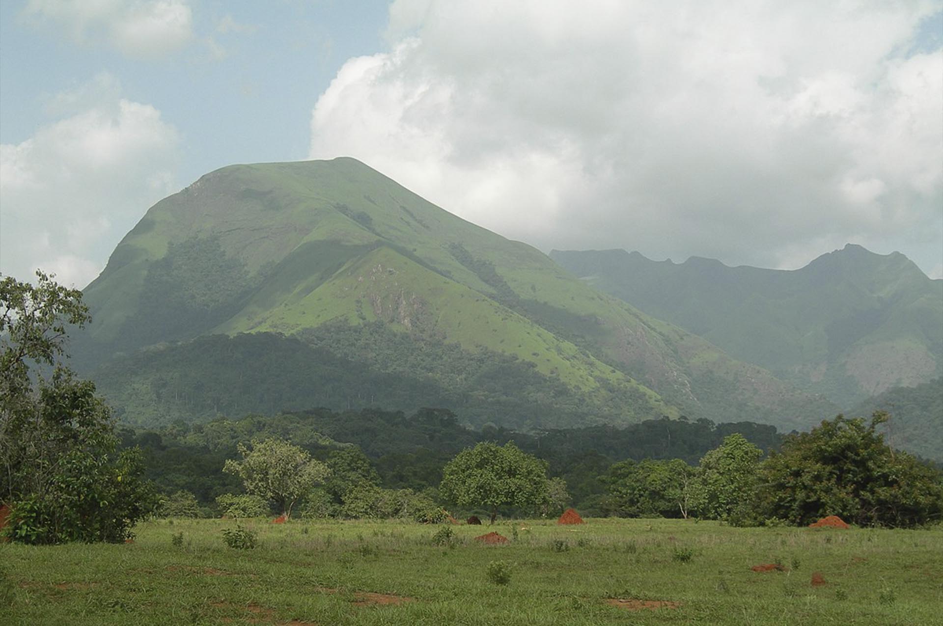
Six transboundary forest landscapes in Liberia, Sierra Leone, Guinea, Côte d'Ivoire and Nigeria.
PAPFor has two main components:
PAPFor is financed through the 11th European Development Fund, under the supervision of CEDEAO and UEMOA, representing the beneficiary countries.
The duration of the programme is 5 years (2019-2024), with a provisional budget of 20 million euros.
93% of the budget is allocated to component 1 (field programme) and 7% to component 2 (regional convergence and coordination).
Through field programmes in 6 priority forest landscapes:
As the majority of the remaining Guinean forests are in Liberia and as four of the six landscapes cover Liberia, the regional coordination of PAPFor is based in Monrovia.
The offices of the regional coordination are located at the Society for Conservation of Nature in Liberia and the structure will be light in structure.
Working closely with national administrations and regional institutions, and supporting the six landscapes, regional coordination focuses on three main outcomes:
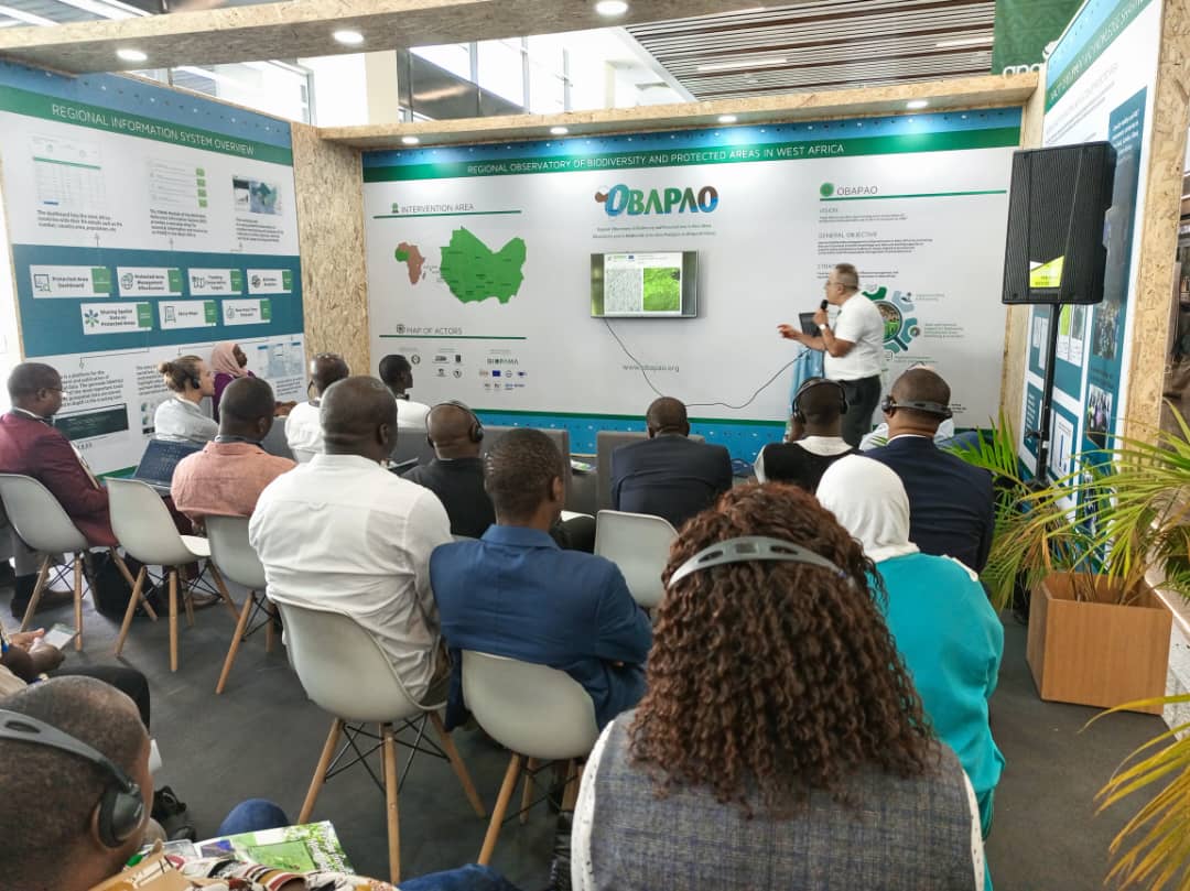
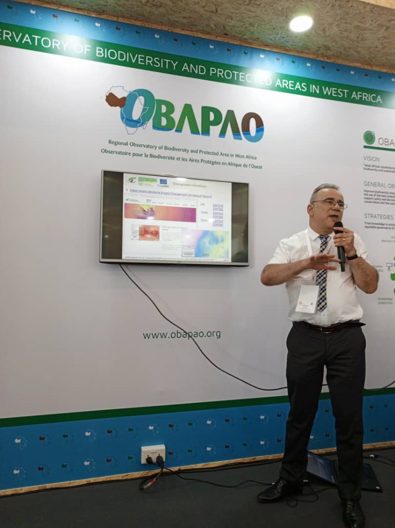
Several studies have been conducted to highlight the impact of protected areas on forest cover conservation.
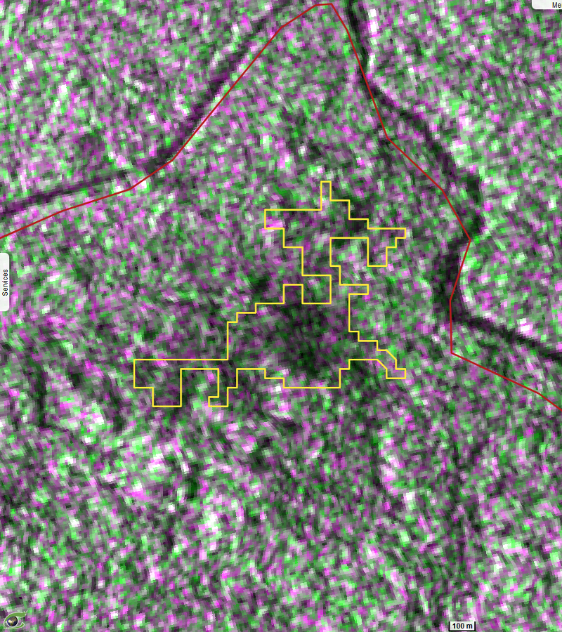
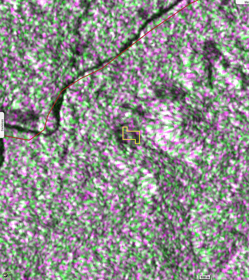
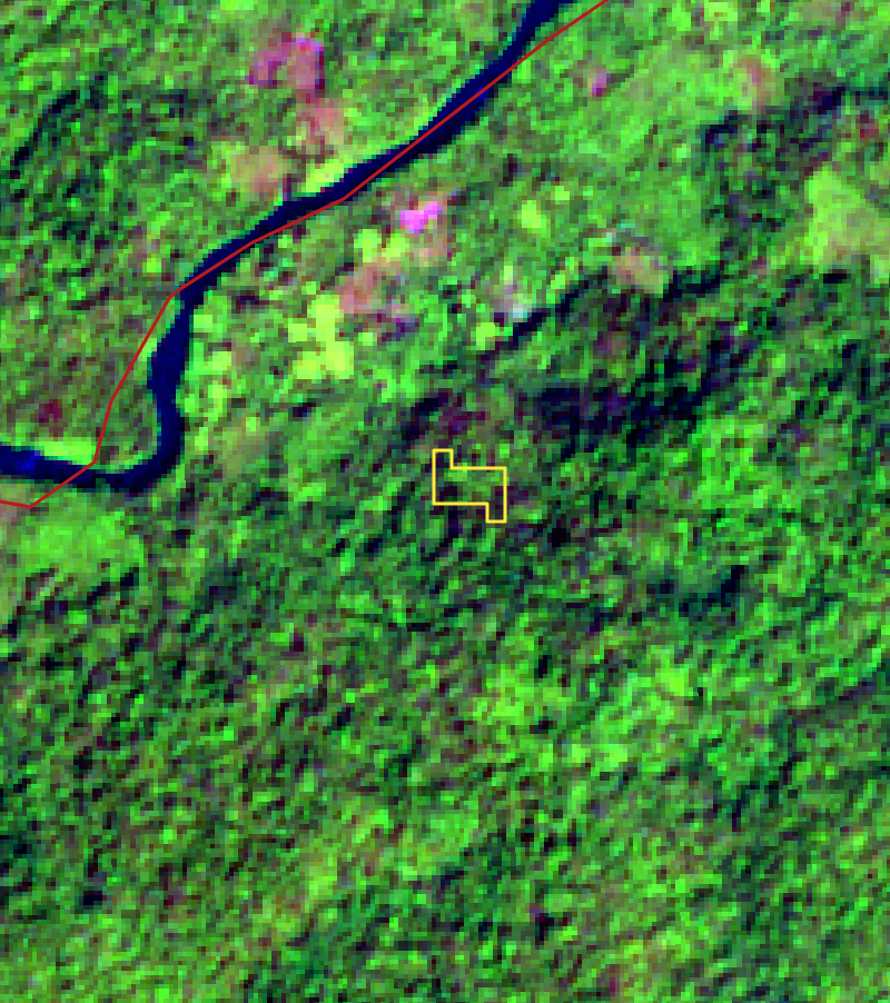
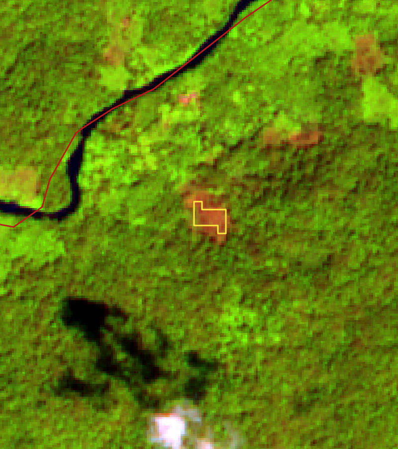
FLEGT Watch is an automatic deforestation detection system for Central and West Africa using Sentinel-1 radar satellite images Sentinel-1. This section shows three examples of deforestation detected by FLEGTWatch in Gola Forest National Park (Liberia).
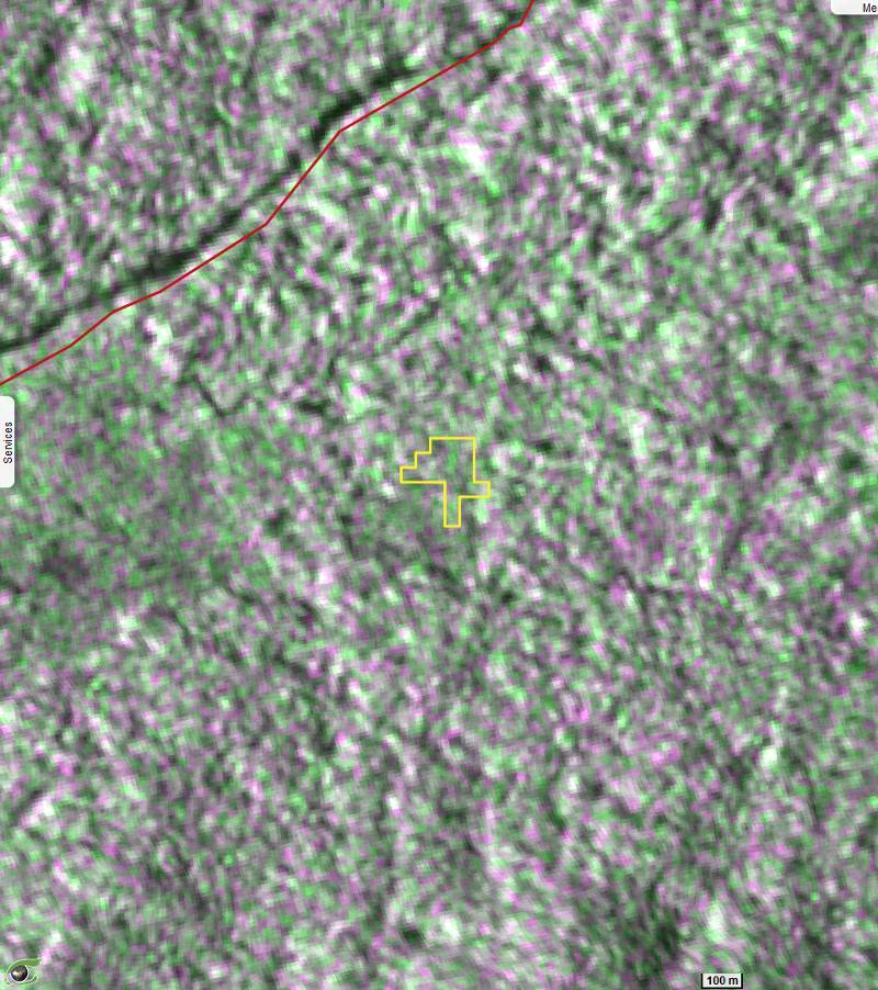
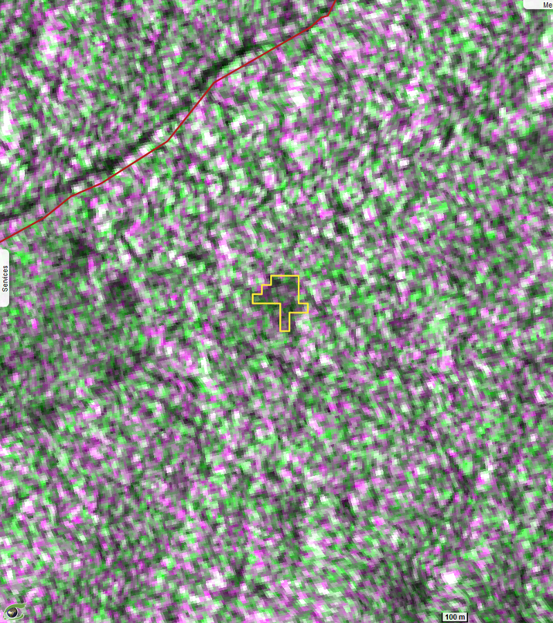
In radar images A and B, an extension of deforested areas can be seen in the north-western part of Gola Forest National Park.
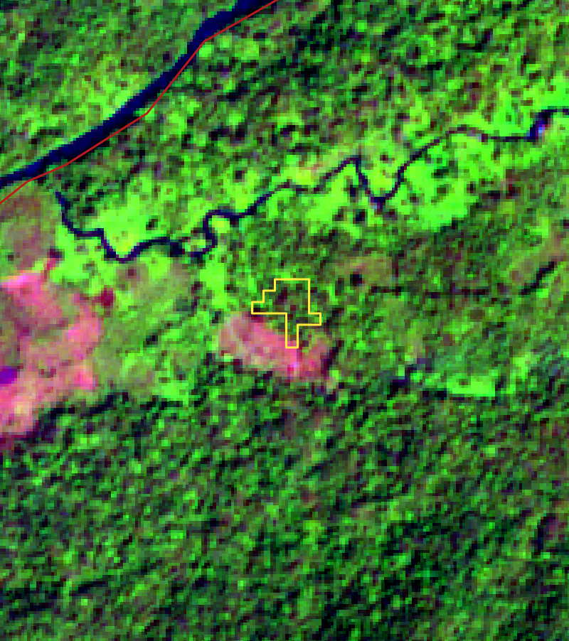
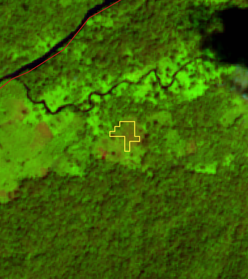
Optical image analysis Sentinel-2 (C and D) confirms that the forest (C) was clearly cut in April 2020 (D).
view the event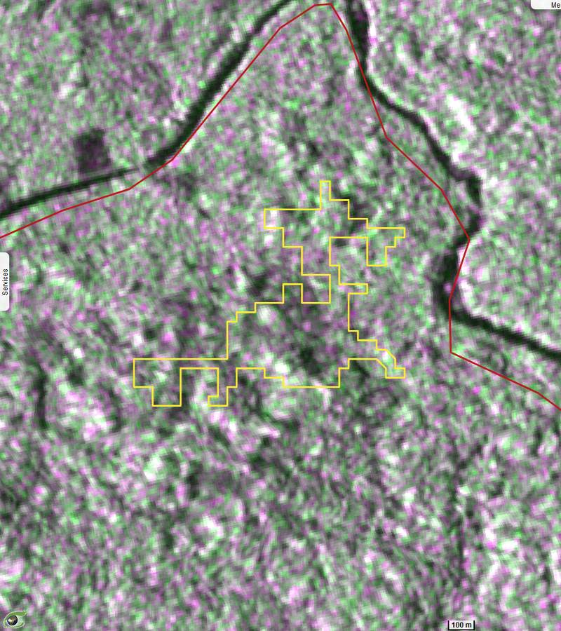
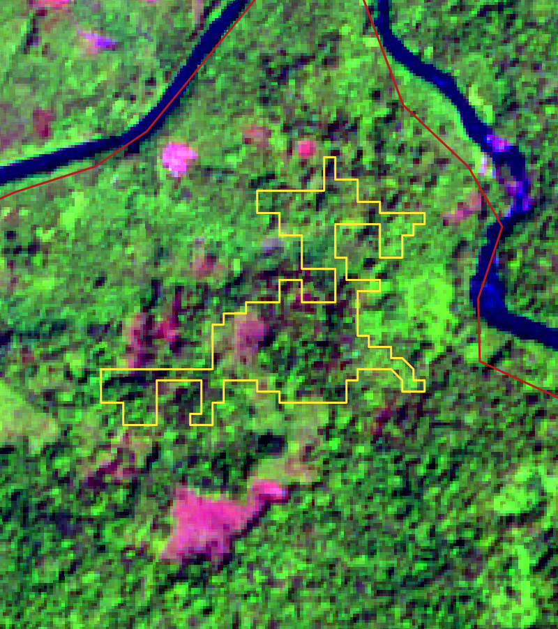
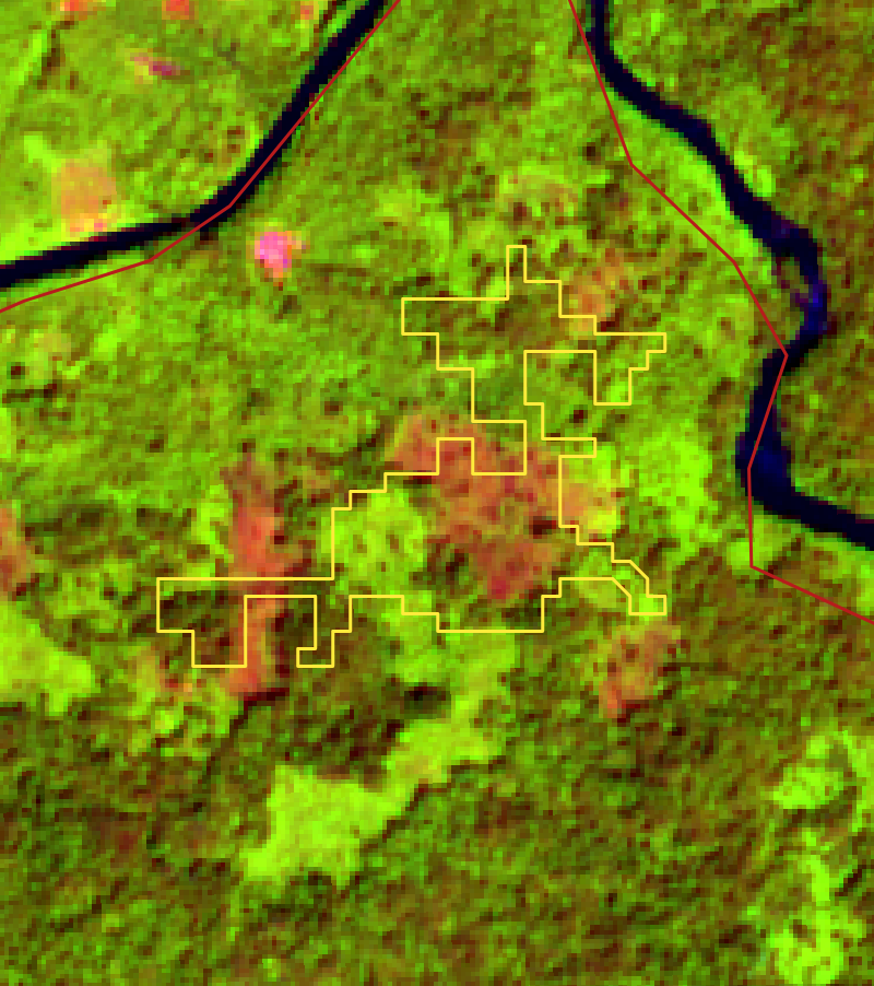
This deforestation occurs in the north-western part of Gola Forest National Park, 200 meters south-east of Nyekehun village.
Analysis of Sentinel-2 optical images (C and D) confirms that the forest remnants observed in A are no longer present in B. It should be noted that the almost permanent cloud cover over the area made it necessary to search for optical data well before the event of May 05, 2020 (first cloudless image on 14.01.2020) and well after the event (first cloudless image on 14.11.2020).
view the event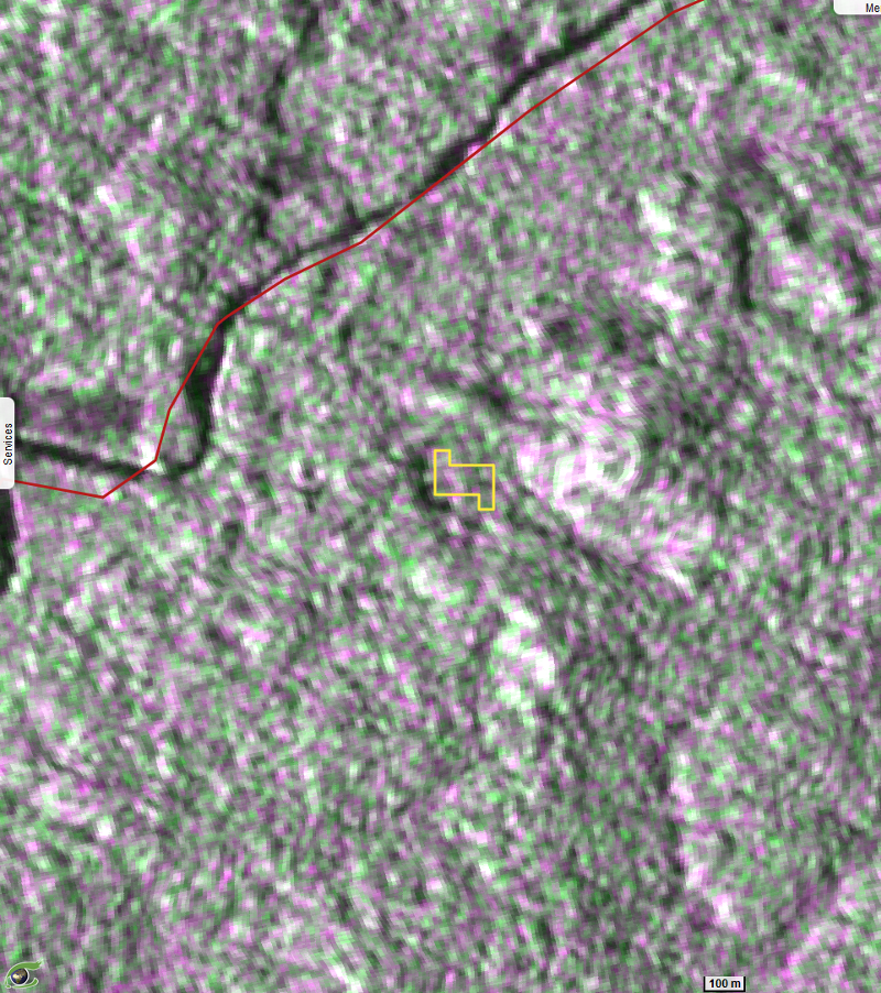
In the imaged radar (A and B), a clear cut can be observed between 5 and 17 May 2020. This deforestation occurs in the north-western part of Gola Forest national park 400 meters south of the village of Morta
The analysis of the Sentinel-2 optical image (C et D) confirms that the forest (C) has been clearly cut (D) revealing a clearing of about one (1) hectare.
This phenomenon of “nibbling” around parks is common especially when it occurs near villages.
One may note here the proximity of the border between Liberia and Sierra-Leone.
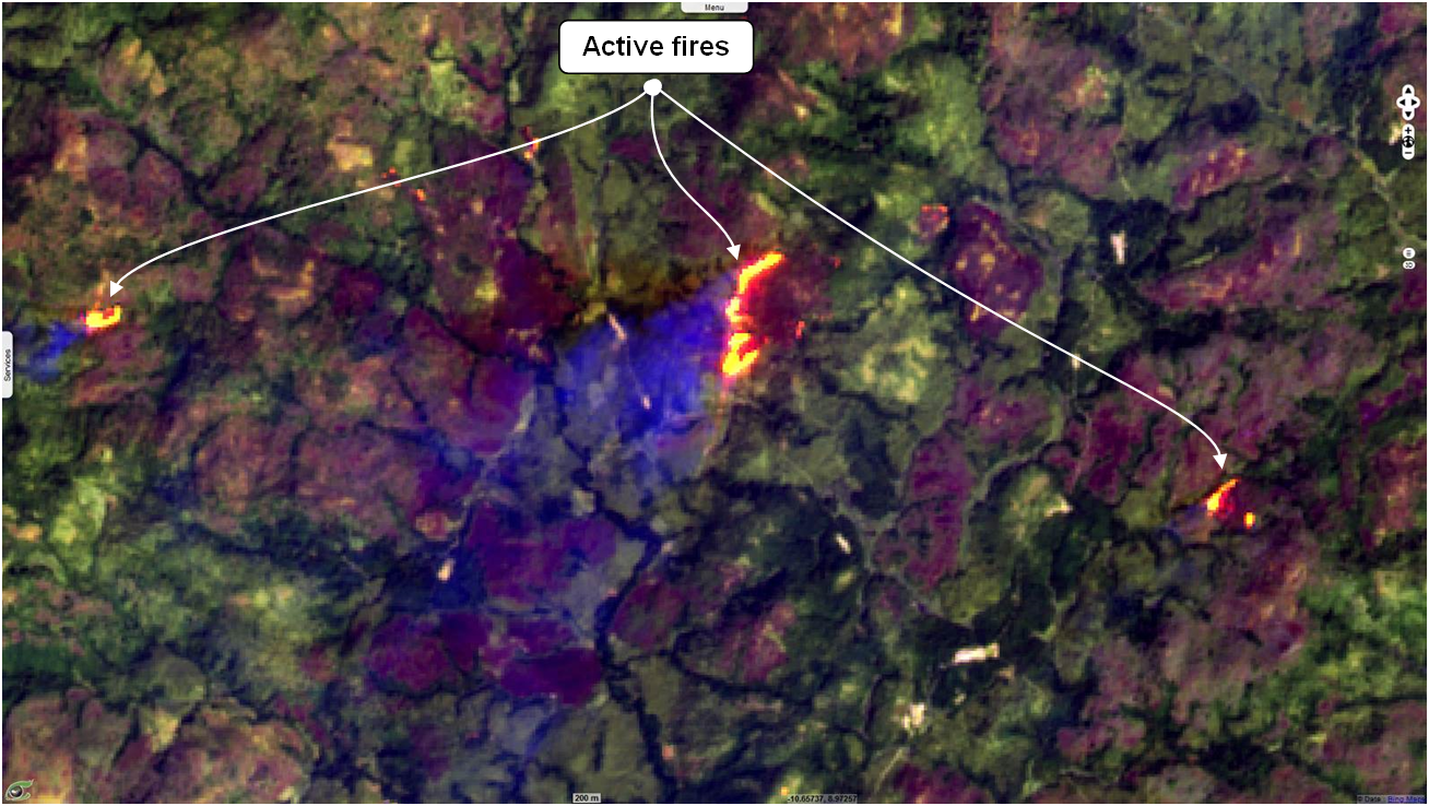
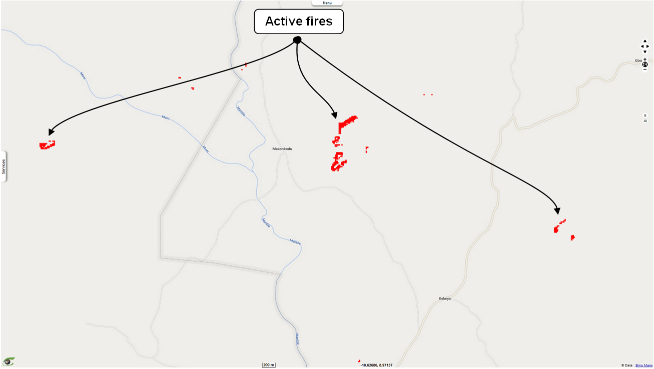
view the eventA novel algorithm automatically detects active fire fronts from Sentinel-2 optical data.
The figure above shows a Sentinel-2 image acquired on January 14, 2020 in the dry season. Active fire fronts are appearing in yellow-orange.
Figure B shows in red the result of the segmentation of the active fire fronts observed in the image A. From this segmentation, we can calculate the fire occurrences.
The detection of active fires can be used for early warning of fires.
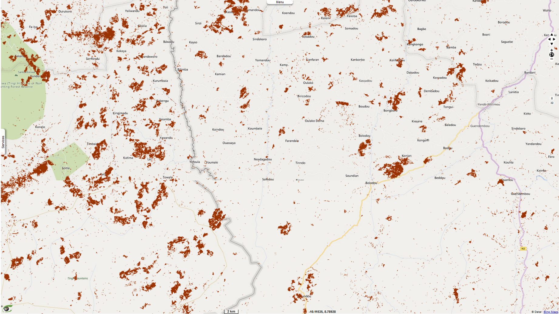
view active firesFigure C shows a Sentinel-2 image acquired on January 14, 2020. One may observe burnt areas appearing in magenta.
Figure D shows in brown the result of the segmentation of the burnt areas observed in the image C. From this segmentation, we can calculate the occurrences of burnt areas.
view the burnt areas